Wednesday, July 20, 2011
Abort
Due to sickness on board, we had to cancel the trip. Sorry about that. Hopefully we will get another chance another time.
Saturday, July 16, 2011
Longyearbyen

View from the kitchen, my working place for the coming 10 days.
Thursday, July 14, 2011
Off to Spitsbergen

Tomorrow, I will travel north again.
My friend and captain Geir is waiting for me in Longyearbyen on board of Ulla Rinman. We will sail on a 10-day cruise north of Spitsbergen, hoping to meet some polar bears and shoot them - on camera that is. I'm not sure we will have internet access continuously, but check this blog for a daily report from the arctic ice sheets.
Sunday, June 19, 2011

Sunday, June 05, 2011

Wednesday, June 01, 2011
Epilog

Back in Tromsø.
Next expedition will be in July: from 17.7 til 25.7, into the ice zone North of Spitsbergen. I will join captain Aasebøstøl on board the former Swedish rescue vessel Ulla Rinman. We will sail with 12 professional photographers on a hunt for polar bears. I will be "the Belgian cook" for these guys, making sure they don't starve.
Tuesday, May 31, 2011
Monday, May 30, 2011
Sunday, May 29, 2011

West
79°50'8.62"N, 7°23'41.41"E
Heading West to take more water samples with the CTD: measuring temperature and salinity.

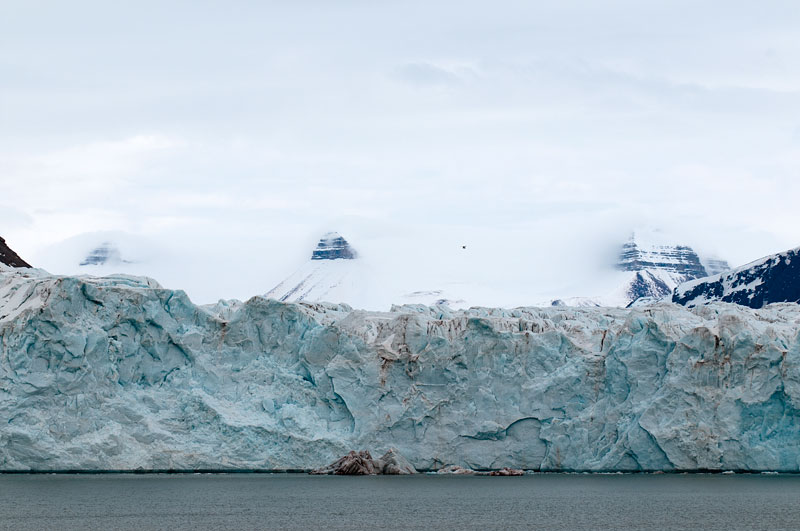
Another blue ice picture, taken in front of the Wagonway glacier at Magdelenefjorden.
Heading West to take more water samples with the CTD: measuring temperature and salinity.

Another blue ice picture, taken in front of the Wagonway glacier at Magdelenefjorden.
Saturday, May 28, 2011
Polar bear

Marginal ice zone, North of Spitsbergen.
Polar bear on the horizon, nose up, sniffing the air. Kokken is frying beef downstairs, smells good indeed. The bear is coming closer and closer, it is a young one, in good shape and well fed.

Friday, May 27, 2011
Magdelenefjorden
79°35'1.20"N - 10°24'14.13"E

Tonight, we sailed from the Fram Strait back to Spitsbergen and arrived at Amsterdam island, just outside Magdelenefjorden. The fjord was very foggy and ghostly.
We visited the former whaling station and graveyard at Smeerenburg, anno 1612, where British, Dutch and German whalers are buried. We went ashore with the Zodiacs and met some incredible blue ice underway.

Afterwards, we moved close to the glacier and stayed there for some hours. It is quiet, the only noise comes from the "clicking" ice: small bubbles of oxygen popping free during melting.
79°43'35.34"N - 11° 1'27.89"E
Next was a visit to another Dutch whaling station, anno 1614. There were 3 walruses lying around on the beach and farting away. And another trip to Virgo Beach with the Zodiacs.

It has been a very busy day. We will stay at Smeerenburg for some hours so everyone can send their emails. The coming days, we will sail north, into the polar ice.
Thursday, May 26, 2011

Ice front
78°50'43.25"N - 2°50'42.74"E

We are surrounded by ice and looking for a big slab to put us down with the crane. It is beautiful sunny day and quiet, the ice breaks all waves. No seasickness today.
There is a large Spanish delegation of CSIC on board: scientist, journalists, writers and filmmakers, a very interesting group. Every day, we get lectures by the participants, about their work in relation to climate change.

Wednesday, May 25, 2011
Fram Strait

Sailing day
It is a rough sea outside and people are mostly in their cabins. White foamy waves hitting the ship, it is rocking and rolling. We are heading North-West, into the Fram Strait. Tonight, we will hit the ice front.
Tuesday, May 24, 2011
Hornsund


Strong wind and lots of drifting ice prevented us from going ashore today and visit the Polish station. It is a bright and sunny day. We sail into the fjord and it is absolutely beautiful: see Hornsund and die.
Monday, May 23, 2011
Barentsburg

Russian mining town, 400 people currently living there now.
Nice break with beer and vodka.


Pyramiden

Breakfast. We are in Billefjorden, close to the abandoned Russian settlement Pyramiden. We will go there today, if we find a way to get there. The fjord is full of ice and we will probably have to walk over it.
A ghost town in the middle of the Arctic. The Russians had a coal mine here from the seventies. In the middle of the nineties, Arktikugol, the company that ran the settlement, decided to shut it down and over 1000 people were evacuated in 4 days time. People literally put their spoons down at the dinner table and left. It is a complete self-supporting society: with its own powerplant, swimming pool, people's house, you name it.
It has a very sad aura.
Subscribe to:
Posts (Atom)